A map of Loyalty Islands is an essential tool for navigating the three main islands of New Caledonia: Lifou, Maré, and Ouvéa. These coral atolls are located east of Grande Terre. A detailed map highlights key infrastructure like airports, ferry ports, and the main road networks connecting pristine beaches and tribal villages.
Geographical Overview of the Loyalty Islands
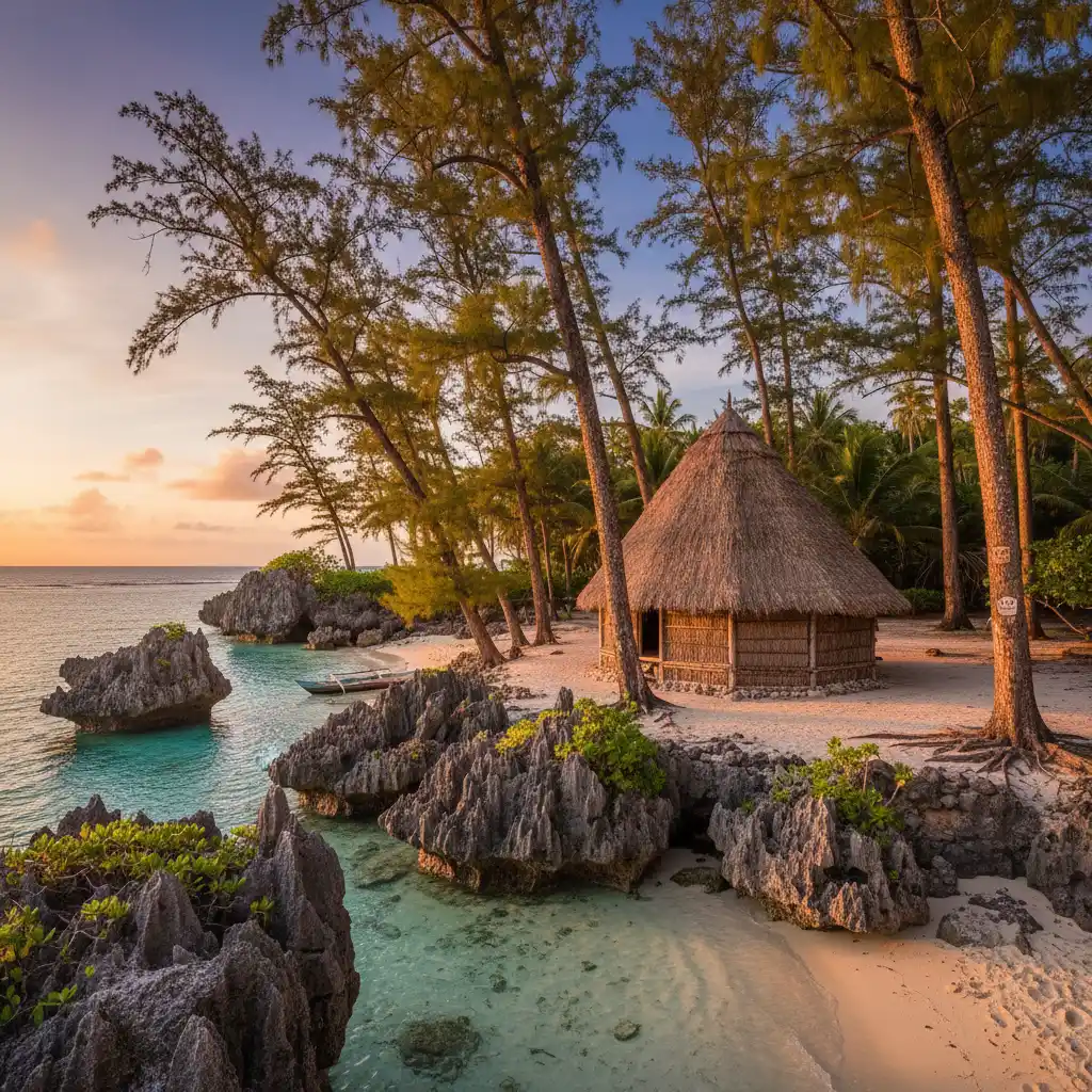
For New Zealanders looking for a tropical escape that is distinct from the usual haunts of Fiji or Rarotonga, the Loyalty Islands (Îles Loyauté) offer a unique blend of Melanesian culture and French sophistication. Located roughly 100 kilometers east of New Caledonia’s main island, Grande Terre, this archipelago consists of three primary islands: Lifou, Maré, and Ouvéa. Each island is a raised coral atoll, boasting a topography that ranges from dramatic limestone cliffs to some of the world’s most pristine white-sand beaches.
Understanding the map of Loyalty Islands is the first step in planning a successful itinerary. Unlike the mountainous terrain of the mainland, the Loyalty Islands are relatively flag, though they are geographically diverse. Lifou is the largest, Maré is the highest and most rugged, and Ouvéa is the quintessential “island paradise” with a continuous 25-kilometer stretch of sand. Navigating these islands requires an understanding of their tribal districts, as the land is largely held under customary ownership, making a reliable map and local orientation vital for respectful exploration.
Detailed Map of Lifou (Drehu)
Lifou, known locally as Drehu, is the administrative center of the Loyalty Islands and the largest in terms of landmass. When looking at a map of Lifou, you will notice it is divided into three main customary districts: Wetr in the north, Gaïca in the center, and Lössi in the south. The island’s shape is irregular, characterized by deep bays and jagged limestone capes.
The Central Hub: Wé
Wé is the main town and administrative heartbeat of Lifou. On your map, you will find it situated on the east coast, nestled in Chateaubriand Bay. This is where you will find the highest concentration of services, including banks, supermarkets, and the provincial government buildings. Most visitors use Wé as a base before heading out to the more remote corners of the island.
Northern Wonders: Jokin and Easo
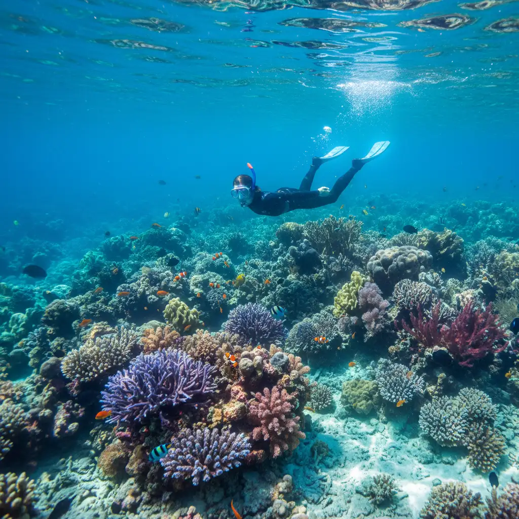
The northern tip of Lifou is home to the Jokin Cliffs, a breathtaking site where fossilized coral cliffs plunge into a sea teeming with marine life. Nearby is Easo, a significant village on the map because it serves as the primary port for cruise ships. The Notre Dame de Lourdes chapel sits atop a hill here, providing a 360-degree orientation point for the entire Santal Bay.
Southern Serenity: Luengoni and Mu
The southern district of Lössi features Luengoni Beach, often cited as one of the most beautiful in the Pacific. On a detailed map, look for the “hidden” freshwater sinkholes (grottes) located inland from the coast. These are accessible only with local guides and represent the unique geological makeup of the island’s raised coral structure.
Detailed Map of Maré (Nengone)
Maré, or Nengone, is the most southerly and highest of the Loyalty Islands. Its map reveals a landscape defined by wild, untamed beauty. The island is essentially a series of concentric terraces rising to a central plateau. Because of its rugged nature, Maré feels more secluded and traditional than Lifou.
La Roche and Tadine
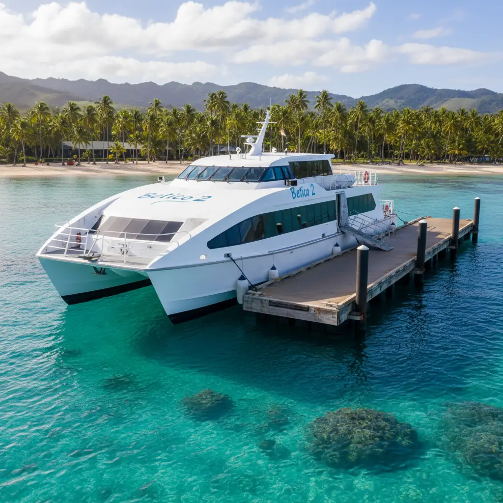
The map of Maré highlights two primary settlements. La Roche, located in the north, is home to the island’s domestic airport. Tadine, on the west coast, is the main village and the arrival point for the Betico 2 ferry. The road connecting these two hubs passes through the center of the island, cutting through dense tropical forests and limestone outcrops.
Natural Landmarks: The Warrior’s Leap
One of the most famous points on the Maré map is the ‘Saut du Guerrier’ (Warrior’s Leap) near La Roche. This is a narrow cleft in the coral cliffs where, according to legend, a warrior leapt across to escape his enemies. Further south, the ‘Aquarium Naturel’ is a must-see; it is a natural rock pool filled with tropical fish and turtles, clearly marked on most tourist maps of the Eni and Wabao districts.

Detailed Map of Ouvéa (Iai)
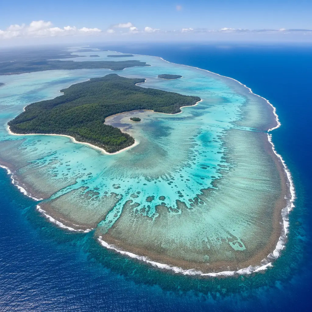
Ouvéa is often described as the “island closest to paradise.” Its map is the simplest of the three, consisting of a long, narrow strip of land that curves around a spectacular turquoise lagoon. The lagoon is a UNESCO World Heritage site, and the island’s orientation is almost entirely north-to-south.
The Mouli Bridge
The most iconic landmark on the Ouvéa map is the Mouli Bridge (Pont de Mouli). It connects the main island to the smaller Mouli Island. From the bridge, visitors can look down into a natural channel where rays and sharks are frequently seen. This is the southern terminus of the main road and serves as a primary orientation landmark for visitors staying at the nearby resorts.
The Pleiades Islets
To the north and south of the main crescent of Ouvéa lie the Pleiades—chains of small uninhabited islets. While these aren’t accessible by car, they are prominent features on any nautical map of the Loyalty Islands. Boat excursions to the Northern Pleiades are popular for diving and snorkeling, offering a glimpse into the untouched biodiversity of the New Caledonian lagoon.
Airport and Ferry Terminal Locations
Efficient movement between the islands and the mainland (Grande Terre) requires a clear understanding of the transportation hubs. For New Zealand travelers, most journeys begin in Noumea before branching out to the islands.
Air Calédonie Airports
Each island is served by its own domestic airport. On your map, look for these specific locations:
- Lifou: Wanaham Airport (LIF) is located in the north-central part of the island, about a 15-minute drive from Wé.
- Maré: La Roche Airport (LRE) is situated on the northern plateau, roughly 20 minutes from Tadine.
- Ouvéa: Hulup Airport (UVE) is located in the center of the island, near the village of Fayaoué.
The Betico 2 Ferry Terminals
The Betico 2 is a high-speed catamaran that connects Noumea to the Loyalty Islands. The ferry terminals are critical orientation points:
- Tadine (Maré): The primary port for Maré, located on the west coast.
- Wé (Lifou): The ferry docks at the Port of Wé, providing easy access to the island’s main services.
- Ouvéa: Ferry service to Ouvéa is less frequent than to Lifou and Maré, and the docking point is typically near the center of the island.
Key Attractions and Road Networks
The road networks on the Loyalty Islands are relatively straightforward but require caution. Most roads are two-lane bitumen, and traffic is generally light. However, the islands follow the French system, meaning you drive on the right-hand side of the road—a key adjustment for New Zealand drivers.
Navigating Lifou’s Roads
Lifou has the most extensive road network. The main arterial road runs from the north (Jokin) to the south (Mu), with several cross-island roads connecting the east and west coasts. Be mindful that signage can be sparse in tribal areas; always keep a physical map or a downloaded digital map handy.
The Single Road of Ouvéa
Ouvéa is perhaps the easiest to navigate. There is essentially one main road that runs the length of the island. Because the island is so narrow—sometimes only a few hundred meters wide—it is impossible to get lost. The speed limit is strictly enforced at 50km/h and 30km/h in villages to protect local children and livestock.
Maré’s Terrace Roads
Maré’s roads often follow the contours of the coral terraces. The drive from the airport at La Roche to the beaches of the south takes you through various micro-climates. It is important to note that petrol stations are limited on Maré; the main station is in Tadine, so ensure your tank is full before exploring the remote eastern cliffs.
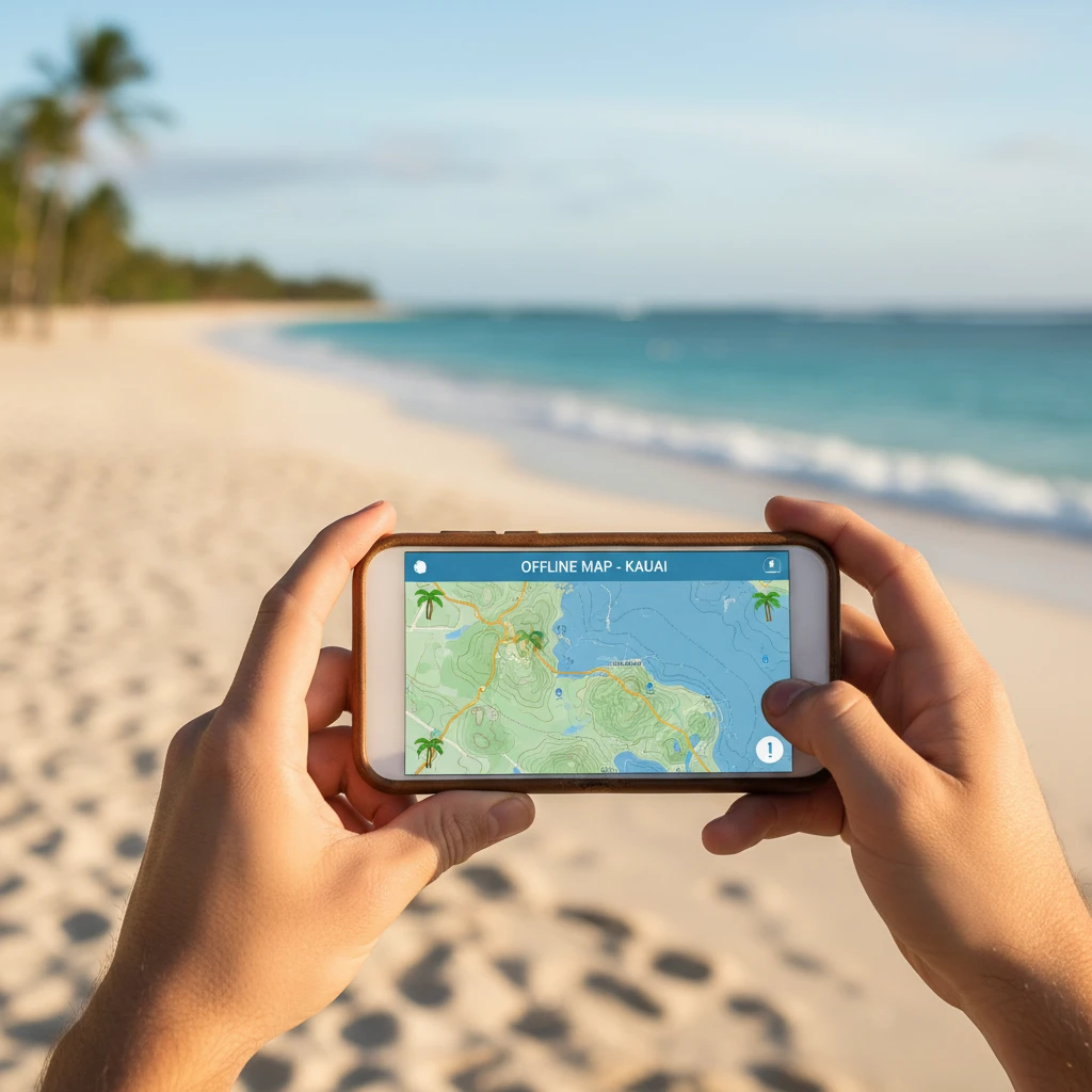
Downloadable PDF Maps for Offline Use
While mobile coverage is generally good in the main villages of Wé, Tadine, and Fayaoué, it can be spotty in the more remote tribal districts. For this reason, having offline maps is highly recommended. New Zealand travelers should consider the following resources:
- Google Maps Offline: Download the entire Loyalty Islands region before leaving Noumea. This allows for GPS tracking even without a data connection.
- Official Tourism PDF Maps: The New Caledonia Tourism board provides detailed PDF maps that include tribal boundaries and cultural sites. These are often more accurate for local landmarks than standard digital maps.
- Maps.me: This app is favored by many Pacific travelers for its detailed topographic data and offline search capabilities for hiking trails and remote beaches.
Orientation Tips for New Zealand Travelers
Traveling to the Loyalty Islands is a different experience than visiting Auckland or Wellington. The pace of life is slower, and the cultural protocols are significant. Here are some final orientation tips:
- Respecting Customary Land: Much of what you see on the map is customary land. If a beach or trail is not explicitly marked as public, it is polite to ask permission (and often pay a small fee) to the local tribe. This is known as “La Coutume.”
- Language: While French is the official language, several Kanak languages are spoken (Drehu, Nengone, Iai). Most maps use French names, but learning the local village names will help you when asking for directions.
- Sunday Closures: On your map, identify the supermarkets in Wé or Tadine. Note that almost everything closes on Sundays. Plan your food and fuel needs accordingly.
- Currency: The CFP Franc is used. While cards are accepted in major hotels and some shops in Wé, cash is king in the smaller villages. Locate the ATMs on your map early in your trip.
By mastering the map of Loyalty Islands, you unlock a world of hidden grottos, pristine reefs, and warm Melanesian hospitality. Whether you are trekking the cliffs of Lifou or lounging on the sands of Ouvéa, proper orientation ensures your Pacific adventure is both safe and unforgettable.
People Also Ask
How do I get from Noumea to the Loyalty Islands?
You can reach the Loyalty Islands via a 40-minute domestic flight with Air Calédonie from Magenta Airport in Noumea, or by taking the Betico 2 high-speed ferry, which takes between 3 to 5 hours depending on the island.
Which is the best Loyalty Island to visit?
It depends on your preference: Lifou offers the most variety and infrastructure; Maré is ideal for rugged nature and hiking; Ouvéa is best for those seeking world-class beaches and a slower pace.
Do I need a 4WD to drive on the Loyalty Islands?
No, a standard 2WD rental car is sufficient for the main roads on Lifou, Maré, and Ouvéa, as most primary routes are sealed and relatively flat.
Is there mobile phone reception on the Loyalty Islands?
Yes, there is generally good 3G/4G coverage in the main towns, but signals can be weak or non-existent in remote coastal areas and inland forests.
Can I visit all three Loyalty Islands in one trip?
Yes, but it requires careful planning. You can fly between the islands or use the ferry, though schedules often require returning to Noumea as a hub between certain islands.
What is the best time of year to visit the Loyalty Islands?
The best time is during the cool, dry season from May to October, when temperatures are pleasant (20-25°C) and the humidity is lower compared to the summer months.